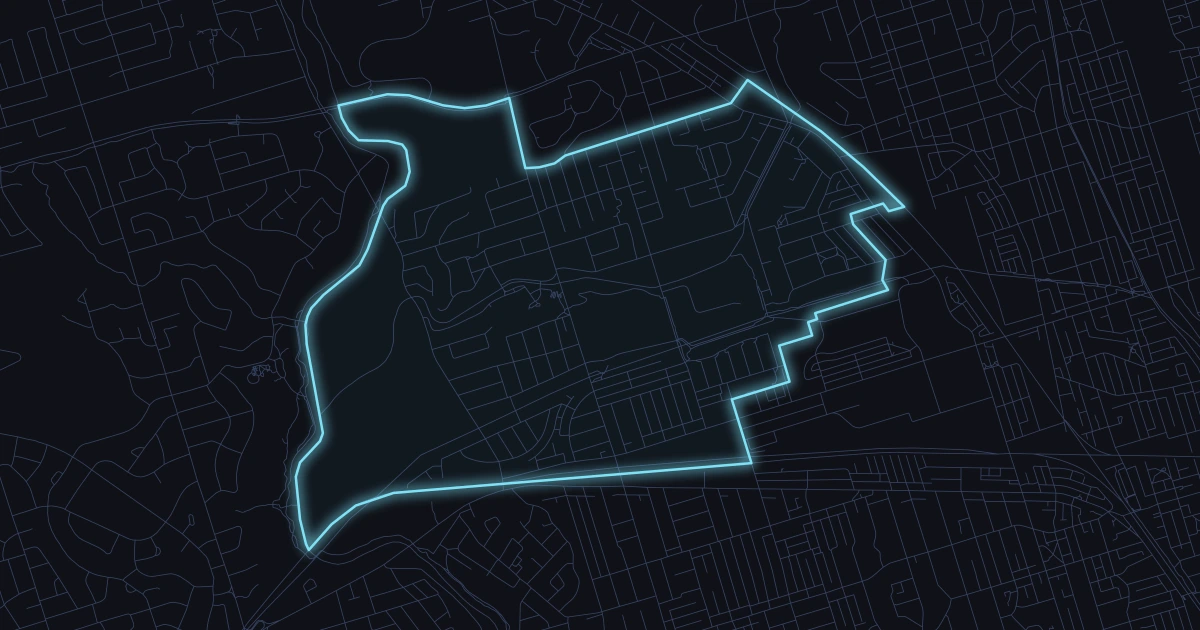
View recent reported crimes in Rockcliffe-Smythe, including crime type breakdowns,
monthly trends, and the latest loaded incidents from Toronto Police open data.
Latest incident
Oct 26
2 days ago
Last 7 days
8
.
Last 30 days
22
.
Last year
308
.
Alerts
Notify me when there is a crime in this area
Safety snapshot
Is Rockcliffe-Smythe safe?
Reported crime data alone cannot establish personal safety. Rockcliffe-Smythe recorded 308 reported crimes in the 365-day period Oct 26, 2025 – Oct 26, 2026, ranking 112 of 158 Toronto neighborhoods from fewest to most reported incidents, including 22 in the last 30 days. That is 13.9 reported incidents per 1,000 residents using the 2021 census population of 22,235. This does not adjust for visitors or population changes since 2021. Read the offence breakdown and local map alongside these totals.
Spatial view
Rockcliffe-Smythe incident map
30-day markers
20
Showing 20 geocoded crimes from the last 30 days in Rockcliffe-Smythe.
High harm Violence Property Other
Compare places
How does another area compare?
See reported incidents and offence types side by side, using the same police source and time period.
Theft from Motor VehicleOtherReligious FacilityRockcliffe-Smythe (111)
Theft from Motor Vehicle
Aug 2, 2026, 10 a.m.
Near Weston Rd / Porter Ave
D12 GO-20261622759
Theft from Motor VehicleOtherReligious FacilityRockcliffe-Smythe (111)
Assault
Aug 1, 2026, 10 p.m.
Near Lydon Ave / Bernice Cres
D12 GO-20261606170
AssaultHouseRockcliffe-Smythe (111)
Sexual Violation | Assault
Aug 1, 2026, 5 a.m.
D12 GO-20261595078
Sexual ViolationAssaultApartmentRockcliffe-Smythe (111)
Sexual Violation
Aug 1, 2026, 12 a.m.
D12 GO-20261593951
Sexual ViolationApartmentRockcliffe-Smythe (111)
Assault
Jul 31, 2026, 9 p.m.
Near Leigh St / McCormack St
D12 GO-20261592770
AssaultCommercialRockcliffe-Smythe (111)
Theft from Motor Vehicle
Jul 29, 2026, 4 a.m.
Near Seneca Ave / Avon Ave
D12 GO-20261576773
Theft from Motor VehicleHouseRockcliffe-Smythe (111)
Break and Enter
Jul 29, 2026, 2 a.m.
Near Humber Blvd / Alliance Ave / Cliff St
D12 GO-20261570300
Break and EnterCommercialCommercial DwellingRockcliffe-Smythe (111)
Theft from Motor Vehicle
Jul 28, 2026, 12 a.m.
Near Henrietta St / Norval St
D12 GO-20261569426
Theft from Motor VehicleApartmentRockcliffe-Smythe (111)
Theft from Motor Vehicle
Jul 27, 2026, 1 p.m.
Near St Clair Ave W / Castleton Ave
D11 GO-20261611920
Theft from Motor VehicleOutsideParking LotRockcliffe-Smythe (111)
Auto Theft
Jul 27, 2026, 9 p.m.
Near Jane St / Ellins Ave
D12 GO-20261566888
Auto TheftStreetRockcliffe-Smythe (111)
Assault
Jul 26, 2026, 9 a.m.
Near Scarlett Rd / Eileen Ave
D12 GO-20261549187
AssaultApartmentRockcliffe-Smythe (111)
Assault
Jul 26, 2026, 2 a.m.
Near Rockcliffe Blvd / Alliance Ave
D12 GO-20261547736
AssaultCommercialRockcliffe-Smythe (111)
Auto Theft
Jul 25, 2026, 9 p.m.
Near Cripps Ave / Spears St
D12 GO-20261548813
Auto TheftParking LotRockcliffe-Smythe (111)
Auto Theft
Jul 25, 2026, 1 a.m.
Near Homeview Ave / Florence Cres
D12 GO-20261543176
Auto TheftHouseRockcliffe-Smythe (111)
Theft from Motor Vehicle
Jul 24, 2026, 5 a.m.
Near Mariposa Ave / Pritchard Ave
D12 GO-20261788296
Theft from Motor VehicleHouseRockcliffe-Smythe (111)
Auto Theft
Jul 24, 2026, 9 p.m.
Near Jane St / Homeview Ave
D12 GO-20261542193
Auto TheftStreetRockcliffe-Smythe (111)
Theft from Motor Vehicle
Jul 23, 2026, 2 a.m.
Near Weston Rd / Porter Ave
D12 GO-20261552537
Theft from Motor VehicleApartmentRockcliffe-Smythe (111)
Assault
Jul 23, 2026, 8 p.m.
Near Northland Ave / Spears St
D12 GO-20261531337
AssaultOutsideStreetRockcliffe-Smythe (111)
Assault
Jul 22, 2026, 2 a.m.
Near Mould Ave / Corbett Ave
D12 GO-20261545500
AssaultOutsideStreetRockcliffe-Smythe (111)
Assault
Jul 20, 2026, 5 p.m.
Near Jane St / Ellins Ave
D12 GO-20261507920
AssaultOutsideStreetRockcliffe-Smythe (111)
Auto Theft
Jul 18, 2026, 9 p.m.
Near Bruton Rd / Ellins Ave
D12 GO-20261496892
Auto TheftStreetRockcliffe-Smythe (111)
Sexual Violation
Jul 17, 2026, 11 p.m.
D12 GO-20261487823
Sexual ViolationHouseRockcliffe-Smythe (111)
Assault
Jul 14, 2026, 6 p.m.
Near Humber Blvd / Louvain St
D12 GO-20261462779
AssaultApartmentRockcliffe-Smythe (111)
Auto Theft
Jul 14, 2026, 3 a.m.
Near Mariposa Ave / Pritchard Ave
D12 GO-20261460754
Auto TheftHouseRockcliffe-Smythe (111)
Assault
Jul 13, 2026, 5 p.m.
Near Rockcliffe Blvd / Hector Ave
D12 GO-20261453462
AssaultApartmentRockcliffe-Smythe (111)
Auto Theft
Jul 13, 2026, 2 a.m.
Near Jane St / Corbett Ave / Florence Cres
D12 GO-20261450442
Auto TheftStreetRockcliffe-Smythe (111)
Assault
Jul 12, 2026, 10 a.m.
Near Dalrymple Dr / Cameo Cres
D12 GO-20261443659
AssaultCommercialRockcliffe-Smythe (111)
Assault
Jul 12, 2026, 3 a.m.
Near Mould Ave / Corbett Ave
D12 GO-20261442422
AssaultApartmentRockcliffe-Smythe (111)
Break and Enter
Jul 10, 2026, 5 p.m.
Near Scarlett Rd / East Dr
D12 GO-20261453688
Break and EnterHouseRockcliffe-Smythe (111)
Auto Theft
Jul 9, 2026, 7 a.m.
Near Cayuga Ave / Avon Ave
D12 GO-20261427681
Auto TheftStreetRockcliffe-Smythe (111)
Monthly trend
Monthly totals
Latest incident
Oct 26
36
Nov
11
Dec
22
Jan
31
Feb
30
Mar
24
Apr
19
May
23
Jun
36
Jul
32
Aug
24
Sep
18
Oct
Offense mix
Offences in the past year
Categories
8
Assault
129
Theft from Motor Vehicle
75
Auto Theft
52
Break and Enter
31
Sexual Violation
14
Robbery
7
Theft over $5,000
6
Bike Theft
1
Calls for service
Recent Calls to 911
Shown
10
THEFT JUST OCCURRED
BATAVIA AVE - MARIPOSA AVE
SEE AMBULANCE
ST CLAIR AVE W - RUNNYMEDE RD
SEE AMBULANCE
MOULD AVE - ST CLAIR AVE W
DISPUTE
ROCKCLIFFE BLVD - JANE ST
ASSAULT JUST OCCURRED
ALLIANCE AVE - BLACK CREEK BLVD
UNKNOWN TROUBLE
ALLIANCE AVE - DALRYMPLE PARK TRL
ASSAULT JUST OCCURRED
WESTON RD - LANGDEN AVE
DISPUTE
LN E LAPP N MCCORMACK - LAPP ST
ASSAULT JUST OCCURRED
ELLINS AVE - HANEY AVE
DISPUTE
ST CLAIR AVE W - SCARLETT RD
Safety questions
Is Rockcliffe-Smythe safe?
Is Rockcliffe-Smythe safe?
Reported crime data alone cannot establish personal safety. Rockcliffe-Smythe recorded 308 reported crimes in the 365-day period Oct 26, 2025 – Oct 26, 2026, ranking 112 of 158 Toronto neighborhoods from fewest to most reported incidents, including 22 in the last 30 days. That is 13.9 reported incidents per 1,000 residents using the 2021 census population of 22,235. This does not adjust for visitors or population changes since 2021. Read the offence breakdown and local map alongside these totals.
What crimes are most common in Rockcliffe-Smythe?
The most reported crime categories in Rockcliffe-Smythe over the last year are Assault (129), Theft from Motor Vehicle (75), Auto Theft (52).
How many break-ins happened in Rockcliffe-Smythe recently?
2 break and enter incidents were reported in Rockcliffe-Smythe in the last 30 days, and 31 over the last 365 days.
How current is this Rockcliffe-Smythe crime data?
This page is regenerated from Toronto Police Service open data. The most recent loaded incident in Rockcliffe-Smythe occurred on Oct 26, 2026.
How does recent reported crime in Rockcliffe-Smythe compare with earlier weeks?
22 incidents were reported in the latest 30-day window (Sep 26, 2026 – Oct 26, 2026), averaging 0.7 per day. The preceding 60 days had 56 reports, averaging 0.9 per day. These are different-length periods, so compare daily averages. Reporting delays can lower the latest figures; this is not a forecast.
Which area does the Rockcliffe-Smythe data cover?
Official City of Toronto neighborhood boundary for Rockcliffe-Smythe.