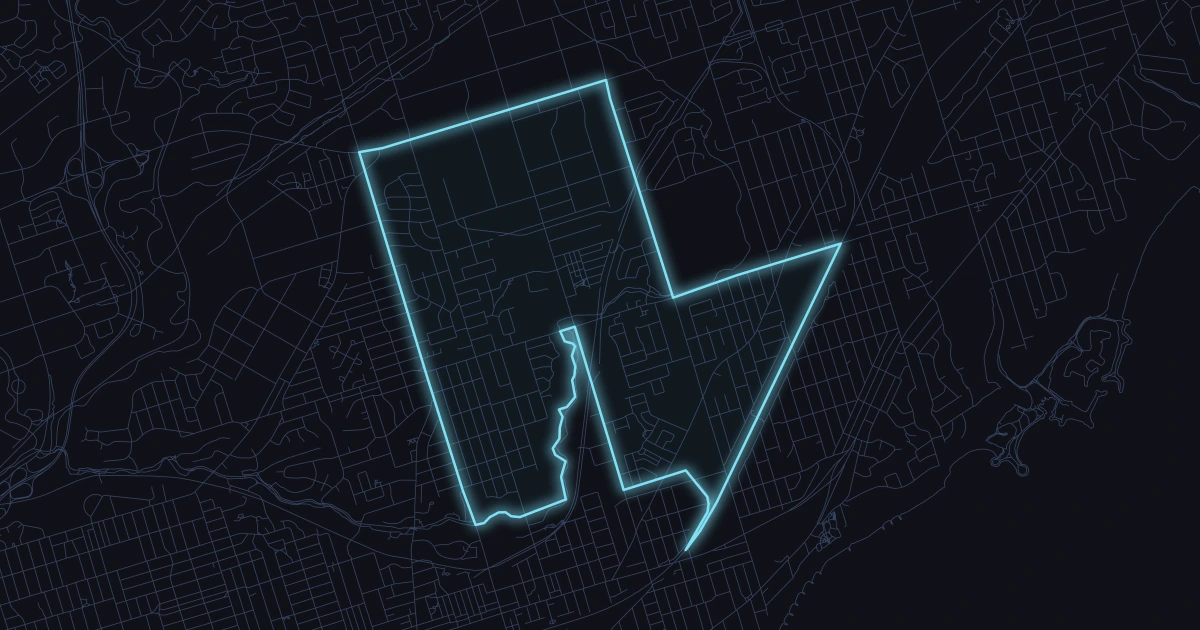
View recent reported crimes in Clairlea-Birchmount, including crime type breakdowns,
monthly trends, and the latest loaded incidents from Toronto Police open data.
Latest incident
Oct 26
2 days ago
Last 7 days
11
.
Last 30 days
36
.
Last year
606
.
Alerts
Notify me when there is a crime in this area
Safety snapshot
Is Clairlea-Birchmount safe?
Reported crime data alone cannot establish personal safety. Clairlea-Birchmount recorded 606 reported crimes in the 365-day period Oct 26, 2025 – Oct 26, 2026, ranking 144 of 158 Toronto neighborhoods from fewest to most reported incidents, including 36 in the last 30 days. That is 22.6 reported incidents per 1,000 residents using the 2021 census population of 26,840. This does not adjust for visitors or population changes since 2021. Read the offence breakdown and local map alongside these totals.
Spatial view
Clairlea-Birchmount incident map
30-day markers
33
Showing 33 geocoded crimes from the last 30 days in Clairlea-Birchmount.
High harm Violence Property Other
Compare places
How does another area compare?
See reported incidents and offence types side by side, using the same police source and time period.
Theft over $5,000ApartmentClairlea-Birchmount (120)
Break and Enter
Aug 6, 2026, 4 a.m.
Near Hollydene Rd / Camrose Cres
D41 GO-20261632534
Break and EnterHouseClairlea-Birchmount (120)
Assault
Aug 5, 2026, 12 a.m.
Near Danforth Rd / Blanche Ave
D41 GO-20261631014
AssaultHouseClairlea-Birchmount (120)
Monthly trend
Monthly totals
Latest incident
Oct 26
66
Nov
50
Dec
58
Jan
58
Feb
37
Mar
54
Apr
55
May
60
Jun
46
Jul
45
Aug
32
Sep
31
Oct
Offense mix
Offences in the past year
Categories
10
Assault
271
Theft from Motor Vehicle
115
Auto Theft
107
Break and Enter
66
Theft over $5,000
24
Sexual Violation
22
Robbery
14
Bike Theft
3
Calls for service
Recent Calls to 911
Shown
10
SEE AMBULANCE
EGLINTON SQ - EGLINTON SQ
HAZARD
CLEANSIDE RD - UPTON RD
SEE AMBULANCE
SHERRY RD - CIVIC RD
PROPERTY DAMAGE COLLISION
VICTORIA PARK AVE - EGLINTON SQ
HOLDING LOST ELDERLY
ST BEDES RD - BOLSTER AVE
DISORDERLIES
EGLINTON AVE E - COMSTOCK RD
THEFT JUST OCCURRED
MOREAU TRAIL PARK TRL - VIANNEY AVE
ASSAULT
TIAGO AVE - BASSETT AVE
ASSAULT JUST OCCURRED
TIAGO AVE - BASSETT AVE
PROPERTY DAMAGE COLLISION
BIRCHMOUNT RD - DANFORTH RD
Safety questions
Is Clairlea-Birchmount safe?
Is Clairlea-Birchmount safe?
Reported crime data alone cannot establish personal safety. Clairlea-Birchmount recorded 606 reported crimes in the 365-day period Oct 26, 2025 – Oct 26, 2026, ranking 144 of 158 Toronto neighborhoods from fewest to most reported incidents, including 36 in the last 30 days. That is 22.6 reported incidents per 1,000 residents using the 2021 census population of 26,840. This does not adjust for visitors or population changes since 2021. Read the offence breakdown and local map alongside these totals.
What crimes are most common in Clairlea-Birchmount?
The most reported crime categories in Clairlea-Birchmount over the last year are Assault (271), Theft from Motor Vehicle (115), Auto Theft (107).
How many break-ins happened in Clairlea-Birchmount recently?
2 break and enter incidents were reported in Clairlea-Birchmount in the last 30 days, and 66 over the last 365 days.
How current is this Clairlea-Birchmount crime data?
This page is regenerated from Toronto Police Service open data. The most recent loaded incident in Clairlea-Birchmount occurred on Oct 26, 2026.
How does recent reported crime in Clairlea-Birchmount compare with earlier weeks?
36 incidents were reported in the latest 30-day window (Sep 26, 2026 – Oct 26, 2026), averaging 1.2 per day. The preceding 60 days had 81 reports, averaging 1.4 per day. These are different-length periods, so compare daily averages. Reporting delays can lower the latest figures; this is not a forecast.
Which area does the Clairlea-Birchmount data cover?
Official City of Toronto neighborhood boundary for Clairlea-Birchmount.